Introducing Forkcast: weather planning for long bike trips
- Date:
- From:
- vast <hello@vast.ch>
- To:
- You
- Subject:
- Introducing Forkcast: weather planning for long bike trips
Forkcast is a vast.earth project. It answers one question:
If I set off on this route on this date, what weather will I ride into, day by day?
You can try it at forkcast.vast.earth.
What it is about
You tell Forkcast about your trip:
- the route: draw it on the map, or import it as a GPX file;
- the start date;
- how far you ride each day, and at what average speed;
- how often you rest, for example ride five days, rest one.
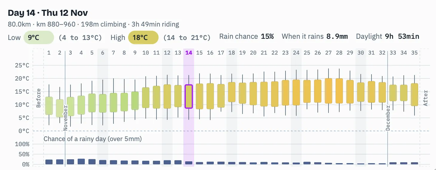
Forkcast works out where you will be on each day of the trip and shows what the weather usually does there at that time of year: the day’s high, the night’s low, the chance of a rainy day, and how much daylight you have. A chart lays the whole trip out day by day:
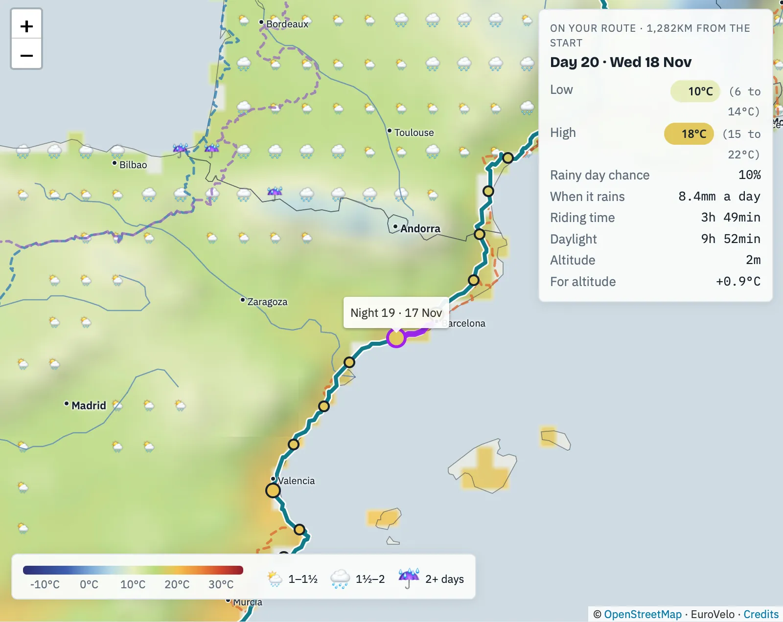
The map shows the same week across the whole region: the colours are the usual day highs, and the clouds and umbrellas mark how many rainy days a week to expect. So you can see where the warm, dry weather is, and move the route or the dates towards it. Point at your route, and Forkcast tells you which day of the trip you would be there and what the weather usually is on that date:
You don’t have to draw your own route: as a convenience, Forkcast comes with all 17 EuroVelo routes built in. EuroVelo is the network of long-distance cycle routes across Europe, coordinated by the European Cyclists’ Federation: from the North Cape to the Mediterranean and from the Atlantic to the Black Sea, over 90,000 km once complete. Pick one, and you can plan a trip on it straight away.
Why
The everyday weather forecast, the one on the TV news, in a weather app or on a website, reaches about ten days ahead at most. But a long bike trip is planned months ahead: when to take time off, which direction to ride, which sleeping bag to pack. For that, what matters is what is typical, and how far it can swing. A trip also crosses hundreds of kilometres over several weeks, and the weather changes along the way.
Forkcast is built on 15 years of climate records: ERA5-Land from the Copernicus Climate Change Service, 2011 to 2025, on a grid of about 25 km. So it is not a forecast:
It tells you what is typical, not what a given year will bring.
The help page explains where every number comes from and how far to trust it.
Who it is for
- Bikepackers and cycle tourists planning a trip of a few days to a few months: when to leave, which way round to ride, or whether a route is still a good idea in November.
- Anyone curious what a place is usually like in a given week.
Why we made it
Planning our own trips, we kept piecing the weather together by hand: a forecast that didn’t reach far enough, and guesses for everything beyond it. Forkcast puts it all on one map, along the route, on the day you’ll be there.
It is also what vast.earth is for: something useful, free and open.
- No accounts, no ads, no tracking.
- Your plan lives in the link, so you can bookmark it or send it to whoever you ride with.
- Nothing about you or your trip leaves your browser.
- The code is open source on GitHub.
Questions, ideas or a bug to report? Open an issue, or come and talk to us on Discord.